Link roads in the Maldives: islands you can drive between
Most Maldivian islands are reached by boat, but a few are joined by road. A guide to the Sinamalé Bridge, the Addu and Laamu link roads and new bridges being built.
 By Dhiffushi Island Council8 min readUpdated
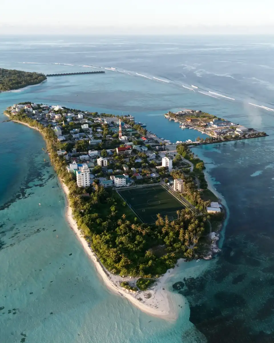
In the Maldives you can only drive between a handful of islands. Most of the country’s islands are separated by lagoons and deep channels, so boats and planes do the work. The main exceptions are Malé, the airport and Hulhumalé, joined by the Sinamalé Bridge; the Addu Link Road in the far south; and the Laamu link road. A few smaller links are being built or rebuilt.
Why so few islands are joined by road
The Maldives is a chain of coral atolls. Inside each atoll, islands sit on their own reefs and are often separated by channels (*kandu*) where strong currents run between the lagoon and the open ocean. Bridging deep, fast water is costly, and filling in a shallow lagoon to make a causeway can block the flow of water that keeps reefs and beaches healthy.
So most travel between islands is by speedboat, public ferry, domestic flight or seaplane. The links that do exist are where islands share a reef or a shallow lagoon, or where the government has decided a bridge is worth the cost. For the wider picture, see getting around the Maldives and currents and channels in the Maldives.
The Sinamalé Bridge: Malé, the airport and Hulhumalé
The best-known link is the Sinamalé Bridge. It is about 1.4 km long and opened on 30 August 2018. It joins Malé to Hulhulé, the airport island, and the road carries on to Hulhumalé, the reclaimed city next door.
For visitors, it means you can reach Malé from Velana International Airport by taxi or public bus as well as by ferry. Helmets have been compulsory on the bridge for riders and passengers since 10 March 2019.
The Thilamalé Bridge: under construction
A second, longer link is being built west of Malé. The Thilamalé Bridge project will join Malé with Villimalé, Gulhifalhu and Thilafushi by road. PSM News describes it as a network of bridges, causeways and roads covering about 6.7 km in total, funded by a USD 100 million grant and a USD 400 million line of credit from India.
The project has been delayed several times. PSM News reported it at around 70% complete in 2026, and the latest government target for opening is the end of 2027. Until then, Villimalé is reached by ferry from Malé, and Thilafushi is an industrial island that visitors don’t go to.
Addu City: the Addu Link Road
Addu City, the southernmost atoll, has the longest-established link road in the country. It runs along the western rim of the atoll and joins five communities:
- Gan, home to the international airport
- Feydhoo
- Maradhoo-Feydhoo
- Maradhoo
- Hithadhoo, the largest island and city centre
Edition reports that the road was built between 2001 and 2003, funded by loans from the Islamic Development Bank and the Asian Development Bank. Reported lengths vary between about 12.5 km and 16 km, depending on which sections are counted.
The rebuild
After years of wear, the government signed a contract in April 2025 to rebuild and widen the road, funded from the state budget (MVR 829.8 million, as reported by Edition). The wider project also covers paving other roads in the city, drainage in Feydhoo, pavements, markings and signs. Work started on site in late 2025. In May 2026, MMTV reported that materials had arrived, surveys were finished and trees were being moved to make room for a four-lane road. The minister responsible told parliament in mid-2026 that he could not give a firm completion date.
Expect roadworks, diversions and dust on parts of the road for some time.
Hulhumeedhoo is not on the road
The island of Hulhumeedhoo, with the communities of Hulhudhoo and Meedhoo, sits across the lagoon on the eastern side of the atoll and is not on the link road. You reach it by boat.
A bridge from Hithadhoo to Hulhumeedhoo has been promised for several years. An agreement for its first design and survey work was signed in February 2024 (President’s Office). In 2026, the Ministry of Construction, Housing and Infrastructure said a fixed bridge had been chosen over a cable car, on a route with four crossings, and that the concept design was under review ahead of an international tender. No construction date had been confirmed.
Laamu Atoll: the Laamu link road
The second long road outside Malé is in Laamu Atoll. It runs along the eastern rim of the atoll on causeways and joins four inhabited islands, from north to south:
- Gan
- Maandhoo
- Kadhdhoo, where the regional airport is
- Fonadhoo
According to PSM News, the road was completed in August 2016 with grant aid from China, and it was formally opened by the president later. PSM gives its length as about 17 km; earlier government and planning documents give shorter figures of about 15 km. Treat it as roughly 15 to 17 km.
Because Kadhdhoo airport sits on the road, you can land and travel to Gan or Fonadhoo without a boat, which is unusual in the Maldives.
Smaller links and works in progress
A few other islands have been joined, or are being joined, by short causeways or bridges. Plans change, so treat these as works in progress:
- Madaveli and Hoadedhdhoo (Gaafu Dhaalu Atoll). A 440 m causeway built in 2018 caused flooding because water could no longer flow across the lagoon, PSM News reported. The government decided to remove it and build two bridges instead, via the uninhabited island of Haadhoo between them. MTCC was given the work in October 2021, and in November 2024 it reported the two bridges at about 80–85% complete.
- Faresmaathodaa (Gaafu Dhaalu Atoll). PSM News has reported work by MTCC on an 800 m link between the domestic airport and the main island.
- Greater Malé. Hulhulé (the airport) and Hulhumalé are joined by road, and the Thilamalé project will add Villimalé, Gulhifalhu and Thilafushi.
The Madaveli story is a useful lesson. Solid causeways can trap water and change how sand moves, which affects beaches and reefs. That is one reason newer projects favour bridges that let water flow underneath. For more on this, see coastal erosion in the Maldives and coral reefs of the Maldives.
Getting around on a link road
Link roads are a pleasant way to see daily life in the south. A few practical points:
- Taxis run along the Addu and Laamu roads. Ask your guesthouse or a local shop to call one, and agree the fare first.
- Scooters and cars. Helmets are compulsory for riders and passengers on roads with a speed limit above 30 km/h, which includes the Sinamalé Bridge, the Hulhumalé highway and the Addu and Laamu link roads. You need a licence that is valid in the Maldives and insurance that covers you. Read our driving and scooters guide before you ride.
- Cycling. Bicycles are a common way to get about on local islands, and a long flat link road is easy riding. Start early or late: there is very little shade, and the midday sun is fierce. Carry water and read our sun safety guide.
- Walking. Short stretches are fine, but the full roads are long and exposed. Wear modest clothing when you pass through villages, as on any local island.
- Weather. Waves can wash over low sections in rough weather. Follow local advice, especially in the southwest monsoon.
Most islands: walk, cycle or take the boat
On most local islands there is nothing to drive to. Dhiffushi, on the eastern rim of North Malé Atoll, is a good example. It is not linked to any other island by road; you arrive by speedboat in about 40–50 minutes from Malé or the airport, or by public ferry (no Friday service). Once there, everything is within walking distance. Our village walk and how to get to Dhiffushi guide show how simple island life can be without roads.
To plan boat links between islands, see public ferries in the Maldives and seaplanes and domestic flights.
Questions people ask
Can you drive between islands in the Maldives?
Only in a few places. You can drive between Malé, the airport island and Hulhumalé over the Sinamalé Bridge. In the south, the Addu Link Road joins Gan, Feydhoo, Maradhoo and Hithadhoo, and the Laamu link road joins Gan, Maandhoo, Kadhdhoo and Fonadhoo. Almost everywhere else, islands are separated by lagoons and channels, so you travel by boat, domestic flight or seaplane.
How long is the Addu Link Road?
Reported figures range from about 12.5 km to 16 km, depending on which sections are counted. The road joins Gan, Feydhoo, Maradhoo-Feydhoo, Maradhoo and Hithadhoo along the western side of Addu Atoll. It was built in the early 2000s and is being rebuilt and widened under a government contract signed in April 2025, so expect roadworks in places for some time.
Is the Laamu link road the longest road in the Maldives?
It is one of the longest stretches you can drive in the country, at roughly 15 to 17 km depending on the source. It joins four islands on causeways along the eastern rim of Laamu Atoll and was completed in 2016. The Addu Link Road is of a similar length. Exact figures vary between government documents and news reports, so treat any single number with care.
When will the Thilamalé Bridge open?
The latest government target is the end of 2027. The project, about 6.7 km of bridges, causeways and roads, will link Malé with Villimalé, Gulhifalhu and Thilafushi. It has been delayed several times, so check recent news before planning around it. For now, Villimalé is reached by a short ferry ride from Malé.
Do I need a helmet on a scooter in the Maldives?
Yes on the main fast roads. Helmets are compulsory for riders and passengers on roads with a speed limit above 30 km/h, including the Sinamalé Bridge, the Hulhumalé highway and the Addu and Laamu link roads. On slower island lanes a helmet is not always required by law, but it is strongly advised. You also need a valid licence and suitable insurance.
Why doesn’t the Maldives build more causeways?
Many islands are separated by deep channels with strong currents, which are very costly to bridge. Where lagoons are shallow, solid causeways can block water flow, causing flooding, erosion and damage to reefs. A causeway in Gaafu Dhaalu Atoll had to be replaced with bridges for this reason. Boats remain the practical way to link most islands.