Where is the Maldives? Facts, map and geography
The Maldives on the map: 26 atolls across the equator south-west of India, around 1,200 islands, the world’s lowest country, plus quick facts on people, language, money and time.
 By Dhiffushi Island Council8 min readUpdated
The Maldives is a chain of low coral islands in the Indian Ocean, south-west of India and Sri Lanka, stretching across the equator. It is made up of 26 natural atolls and around 1,200 small islands, with Malé as its capital and Velana International Airport as the main way in. Almost all of the country is sea; the land is scattered in thin rings of reef, sand and palm trees.
Where is the Maldives on a map?
Find the southern tip of India, then look south-west into the open ocean. The Maldives runs as a long, narrow chain roughly north to south, starting not far below the latitude of southern India and ending just south of the equator. There is no land border with any country. The nearest neighbours are India and Sri Lanka to the north-east, with the Chagos Archipelago further south.
On most world maps the islands are too small to see. Zoom in and you find a double chain of ring-shaped atolls, each a lagoon edged by reef and islands.
Which hemisphere is it in?
Both. Most atolls lie in the northern hemisphere, but the chain crosses the equator, and the southernmost atolls, including Addu, sit just south of it. That is one reason the climate is so steady: hot and humid all year, with seasons set by the monsoon winds rather than by summer and winter. Our best time to visit the Maldives guide explains the dry and wet seasons in detail.
How far is it from Europe, the Gulf and Asia?
The Maldives is a long-haul trip from Europe and North America, and a short one from South Asia. As a rough guide:
- From India and Sri Lanka, flights are short, often a couple of hours.
- From the Gulf, flights are a few hours, and many travellers from Europe connect there.
- From Europe, expect a long flight with or without a stop.
- From East Asia and Australia, routes usually connect through a regional hub.
Almost all international flights land at Velana International Airport on Hulhulé island, beside Malé. From there, every other island is reached by boat, domestic flight or seaplane. See getting around the Maldives for how that works.
Maldives geography: atolls, islands and reefs
What is an atoll?
An atoll is a ring of coral reef around a central lagoon. Coral grew around ancient volcanic islands that slowly sank; the reefs kept growing upwards towards the light. Islands formed on top of the reef from broken coral and sand piled up by waves and currents.
The word “atoll” itself comes from Dhivehi, the Maldivian language (from *atholhu*), so the Maldives quite literally gave the world the name for this kind of landform.
How many islands and atolls are there?
- 26 natural atolls, arranged in a double chain for much of the length of the country.
- Around 1,190–1,200 coral islands. The official tourism board gives 1,192; counts vary slightly because sandbanks appear, shift and disappear.
- About 99% sea. The total territory is around 90,000 km², but dry land adds up to only about 298 km².
- Around 870 km from the northernmost atoll to the southernmost.
For administration, the natural atolls are grouped into 20 administrative atolls, each with a letter code and a name. Kaafu, for example, covers North and South Malé atolls. See our Maldives atolls guide.
How are the islands used?
The 2022 census by the Maldives Bureau of Statistics counted:
- 187 inhabited islands — the local islands where Maldivians live, with homes, mosques, schools and harbours.
- 168 resort islands — private islands leased for a single resort, with their own rules.
- 106 industrial islands — used for things like fish processing, fuel storage or airports.
The rest are uninhabited: small vegetated islands, picnic islands and sandbanks. Many of these are lovely to visit on a day trip; see Maldives sandbanks and picnic islands.
How high is the Maldives above sea level?
Not very. The highest natural point is about 2.4 metres above sea level, on Villingili in Addu Atoll, which makes the Maldives the lowest-lying country in the world. Most islands rise only a metre or so above the high-tide line. This is why sea-level rise matters so much here. We look at the evidence calmly in is the Maldives sinking?
Maldives quick facts
| Fact | Detail |
|---|---|
| Location | Indian Ocean, south-west of India and Sri Lanka, across the equator |
| Capital | Malé |
| Main airport | Velana International Airport, Hulhulé |
| Atolls | 26 natural atolls; 20 administrative atolls |
| Islands | Around 1,190–1,200 |
| Land area | About 298 km² |
| Highest point | About 2.4 m above sea level |
| Population | 515,132 (Census 2022) |
| Language | Dhivehi; English widely used in tourism |
| Religion | Islam (Sunni) |
| Currency | Maldivian rufiyaa (MVR) |
| Time zone | UTC+5, no daylight saving |
| Weekend | Friday and Saturday |
People, capital and daily life
Population
The 2022 census counted 515,132 people: 382,639 resident Maldivians and 132,493 resident foreigners. About 41% of everyone lives in the Malé area, which includes Malé city, Hulhumalé and Villimalé. Elsewhere, island communities are small. Dhiffushi, on the eastern rim of Kaafu Atoll, had about 1,270 people in the same census, which is typical of a mid-sized local island.
The capital: Malé
Malé is a small, densely built island almost completely covered by streets, homes, markets and mosques. It is linked by bridge to the airport island and to Hulhumalé, a newer island built up from reclaimed land. Our Malé city guide covers what to see in a day or a stopover.
Language
The national language is Dhivehi, written in its own right-to-left script called Thaana. English is taught in schools and widely spoken in tourism, government and business, so visitors rarely struggle. A few words of Dhivehi still go a long way; try our Dhivehi phrases for travellers.
Religion and customs
The Maldives is a Muslim country, and Islam shapes daily life, public holidays and dress, especially on local islands. Shops and cafés close for a while around Friday midday prayers. Alcohol is not sold or allowed on inhabited islands. Swimwear is fine on designated bikini beaches; elsewhere, cover shoulders and knees. Our guide to Maldives culture, people and language explains more.
Money
The currency is the Maldivian rufiyaa (MVR), issued by the Maldives Monetary Authority. The official rate is around 15.42 rufiyaa to the US dollar. Dollars are widely accepted in tourism, but local shops and small cafés often prefer rufiyaa. Public ferries take cash in rufiyaa only. For taxes, service charges and daily costs, see Maldives money, costs and taxes.
Time zone
The Maldives uses Maldives Time, UTC+5, all year. There is no daylight saving. If you move between a resort and a local island, confirm transfer times in Maldives time.
What the geography means for your trip
- Every journey involves water. Islands are reached by speedboat, public ferry, seaplane or domestic flight. Plan transfers before you book a room.
- Atolls close to Malé are easiest. North and South Malé atolls are within a short boat ride of the airport. Dhiffushi, for example, is about 37 km north-east of Malé and 40–50 minutes by shared speedboat; read how to get to Dhiffushi.
- The reef is the main attraction. Mantas, turtles and reef fish gather along the atoll rims.
- Local islands and resorts are different worlds. Local islands are real communities with their own customs. Resorts are private islands with their own rules. Our local islands guide explains how to choose.
Where does Dhiffushi fit?
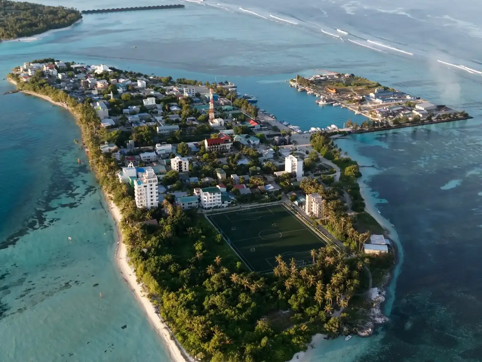
Dhiffushi lies on the eastern edge of North Malé Atoll and is the easternmost inhabited island in the country, so it is “where the Maldives wakes first”. It shows what most of the Maldives really looks like: a small island, a harbour, a mosque, a school, fishing boats and sea in every direction. You can see its layout on our Dhiffushi map.
Questions people ask
Where exactly is the Maldives?
The Maldives is in the Indian Ocean, south-west of India and Sri Lanka. Its chain of 26 atolls runs roughly north to south for around 870 km and crosses the equator, so the southern atolls are in the southern hemisphere. It has no land borders. The capital, Malé, and the main international airport sit next to each other in Kaafu Atoll, near the middle of the chain.
Is the Maldives part of India?
No. The Maldives is an independent country with its own government, currency, language and immigration rules. It is a near neighbour of India and Sri Lanka and has long ties with both through trade and history, but it is a separate nation. Visitors from all countries get a free 30-day tourist visa on arrival if they meet the entry requirements; see our visa guide for details.
How many islands does the Maldives have?
Around 1,190 to 1,200, depending on the source; the official tourism board gives 1,192. According to the 2022 census, 187 are inhabited local islands, 168 are resort islands and 106 are industrial islands. The rest are uninhabited islands and sandbanks. Exact numbers change slightly over time as sandbanks form, shift and wash away.
What language do they speak in the Maldives?
The national language is Dhivehi, written in the Thaana script from right to left. It is related to Sinhala, spoken in Sri Lanka, and borrows words from Arabic, English and other languages. English is widely understood, especially in tourism, shops and government offices, so you can get by easily. Learning a simple greeting is still appreciated on local islands.
What is the time difference in the Maldives?
The Maldives is on UTC+5 all year, with no daylight saving. That puts it half an hour behind India and Sri Lanka, an hour ahead of the UAE, and four or five hours ahead of the UK depending on the season.
Is the Maldives the lowest country in the world?
Yes. Its highest natural point is only about 2.4 metres above sea level, on Villingili in Addu Atoll, and most islands sit around a metre above high tide. That makes it the lowest-lying country on Earth, and one of the most exposed to sea-level rise. Reclaimed islands such as Hulhumalé have been built higher to reduce that risk.