Maldives atolls explained: a visitor’s guide
What an atoll is, why the Maldives counts 26 natural but 20 administrative atolls, what codes like “K.” mean, and how to choose an atoll for a local island trip.
 By Dhiffushi Island Council8 min readUpdated
The Maldives is a chain of coral atolls in the Indian Ocean: rings of reef and low islands around shallow lagoons, stretched over about 871 km of sea. The usual count is 26 natural atolls, which the state groups into 20 administrative atolls, each known by a letter code such as “K.” for Kaafu, plus the capital, Malé. For a first local island trip, the atoll you pick matters less than how far it is from Malé and how you will get there.
What is an atoll?
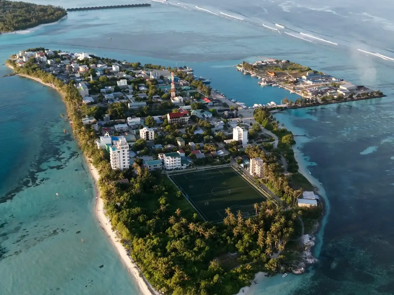
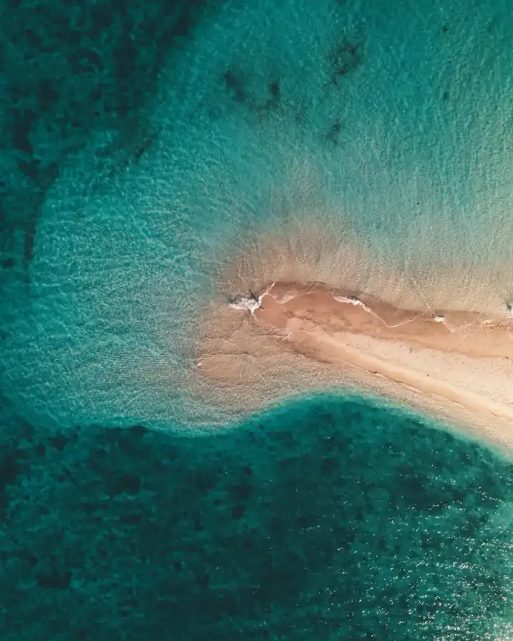
An atoll is a ring-shaped coral reef, or a broken chain of reefs, that encloses a lagoon. Small islands of sand and broken coral build up on the reef rim, and some are big enough for villages, palm groves and an airstrip. Inside the ring the water is calm and shallow; outside, the reef drops away into deep ocean.
The word itself is Maldivian: English took “atoll” from the Dhivehi *atholhu* (އަތޮޅު), most likely by way of Portuguese.
How atolls form
The classic explanation comes from Charles Darwin, writing in the 1840s, and is still the starting point in textbooks such as National Geographic’s education resources:
- A volcano rises from the sea floor and forms an island.
- Corals grow in the warm shallows around its shore, making a fringing reef.
- Over a very long time the volcano cools and slowly sinks. The reef keeps growing upwards, so a lagoon opens between the reef and the shrinking island (a barrier reef).
- Finally the volcano disappears below the surface. What is left is the reef ring and its sandy islands around a lagoon.
Later research has refined the details, but the core idea holds: a reef survives only if coral growth keeps pace with sinking land and rising sea. That is why reef health matters so much here. Most of the world’s roughly 440 atolls are in the Pacific.
How many atolls does the Maldives have?
You will see two numbers, and both are right.
- 26 natural atolls. This is the geographic count, the one used by visitmaldives.com and most reference works. Some “atolls” are large rings with dozens of islands; others are tiny, or even a single island.
- 20 administrative atolls. For government, the natural atolls are grouped into 20 units. A big natural atoll can be split in two (Ari becomes Alif Alif in the north and Alif Dhaal in the south), while Kaafu brings together North Malé, South Malé, Gaafaru and the island of Kaashidhoo.
- Malé City is run as a city in its own right rather than as part of an atoll.
The government’s own atolls site lists all 20 administrative atolls by official name, from Thiladhunmathi Uthuruburi (Haa Alif) in the north to Addu Atholhu (Seenu) in the south. Across them sit about 1,192 islands; in the 2022 census, 187 were inhabited, 168 were resort islands and 106 were industrial islands.
Local government has changed recently. Following amendments to the Decentralisation Act, atoll councils were dissolved in May 2026, and local affairs now sit with island and city councils. The atoll names and letter codes are still how islands are identified in daily life.
Letter codes and Dhivehi names
Every administrative atoll has two names. The official one is geographic and in Dhivehi, such as *Maalhosmadulu Dhekunuburi* (“southern Maalhosmadulu”). The everyday one is a letter of the Thaana alphabet, assigned roughly north to south. The codes were introduced for radio communication between the atolls and Malé, and they stuck because they are short and easy to say.
Where an atoll is split, the code has two letters: *Alif* means north (*uthuruburi*) and *Dhaal* means south (*dhekunuburi*). So Alif Alif is North Ari and Alif Dhaal is South Ari.
You will meet the codes:
- On addresses. An island is written with its atoll code first: “K. Dhiffushi”, “B. Eydhafushi”, “S. Hithadhoo”.
- On boats and ferry signs. Registration plates and timetables often use a code letter with a number.
- In conversation. Maldivians usually say “Kaafu” or “Baa”, rarely the full Dhivehi name.
Island names repeat across the country, so the code tells you which island someone means.
The atolls visitors meet most often
These are the atolls most travellers pass through. Transfer options change, so check current schedules before you book.
| Atoll (code) | Official name | Known for | Usual way in |
|---|---|---|---|
| Kaafu (K.) | Malé Atholhu | North and South Malé atolls, plus Gaafaru and Kaashidhoo; home of the airport and capital region | Speedboat or public ferry from Malé |
| Alif Alif (AA.) | Ari Atholhu Uthuruburi | Northern Ari, with Rasdhukuramathi atoll and Thoddoo island; capital Rasdhoo | Speedboat; seaplane to some islands |
| Alif Dhaal (ADh.) | Ari Atholhu Dhekunuburi | Southern Ari; capital Mahibadhoo; domestic airport at Maamigili | Speedboat or domestic flight |
| Vaavu (V.) | Felidhu Atholhu | South-east of South Malé atoll; capital Felidhoo | Speedboat |
| Faafu (F.) | Nilandhe Atholhu Uthuruburi | Northern Nilandhe; capital Nilandhoo | Speedboat |
| Dhaalu (Dh.) | Nilandhe Atholhu Dhekunuburi | Southern Nilandhe; capital Kudahuvadhoo, which has a domestic airport | Domestic flight or long speedboat |
| Baa (B.) | Maalhosmadulu Dhekunuburi | UNESCO Biosphere Reserve since 2011; Hanifaru Bay manta gatherings | Domestic flight to Dharavandhoo, or seaplane |
| Raa (R.) | Maalhosmadulu Uthuruburi | Northern Maalhosmadulu; capital Ungoofaaru; domestic airport at Ifuru | Domestic flight or seaplane |
| Lhaviyani (Lh.) | Faadhippolhu | Capital Naifaru; Madivaru domestic airport opened in 2022 | Domestic flight or speedboat |
| Gnaviyani (Gn.) | Fuvahmulah | The only one-island atoll, with two freshwater lakes; about 494 km south of Malé | Domestic flight to Fuvahmulah |
| Seenu (S.) | Addu Atholhu | The southernmost atoll; Gan International Airport on a former RAF base | Flight to Gan |
A few notes on the table:
- Ari is one natural atoll split into two administrative atolls. Ask which half an island is in, as transfers differ.
- Baa‘s biosphere reserve covers the whole atoll, with core protected zones such as Hanifaru Bay, where visitor access is controlled. Read our marine life guide before you plan around mantas.
- Addu and Fuvahmulah are far south, close to the equator. They are best treated as a separate trip by air rather than an add-on to the central atolls.
How to choose an atoll for a local island trip
Distance from Malé
Everything starts at Velana International Airport on Hulhulé, next to Malé. The closer your island, the cheaper and simpler the transfer, and the less time you lose on arrival and departure days. Kaafu and the nearer parts of Ari and Vaavu can usually be reached the same day you land, even on an evening flight.
Transfer type and cost
- Shared speedboats are the usual choice within Kaafu and to nearby atolls. They run on set schedules, so match them to your flight times.
- MTCC public ferries are the most affordable option but slow, paid in cash in rufiyaa, and on most routes do not run on Fridays.
- Domestic flights to regional airports make distant atolls practical, often followed by a short boat ride, at a higher cost.
- Seaplanes mostly serve resorts, so they are rarely the affordable choice.
Our getting around the Maldives guide explains each option in more detail.
Ferry links and island hopping
If you want to visit two or three islands, choose them in the same atoll, or in neighbouring ones, where boats link them directly. Crossing between distant atolls usually means going back through Malé. See island hopping in the Maldives for route ideas, and our 7-day local islands itinerary for a worked plan.
What you want to do
Every atoll has reefs, lagoons and quiet islands, so the differences are about access and timing. Surf breaks, manta seasons and dive sites vary by area; our guides to snorkelling, diving and surfing cover where and when.
Kaafu atoll, with Dhiffushi as the example
Here is how the atoll system looks from one Kaafu island.
- Address: K. Dhiffushi. The “K.” tells boat crews and officials it is the Dhiffushi in Kaafu.
- Location: on the eastern rim of North Malé atoll, about 37 km north-east of Malé. It is the easternmost inhabited island in the country, so the sun rises here first.
- Getting there: shared speedboat in about 40–50 minutes from Malé or the airport, or the slower MTCC public ferry, which does not run on Fridays.
- Outer reef: being on the rim means the ocean side is close by, which is why surf and outer-reef trips are within easy reach.
For timings and boat options, see how to get to Dhiffushi, and use our map to see where the island sits in the atoll.
Questions people ask
How many atolls are there in the Maldives?
The usual count is 26 natural atolls, grouped into 20 administrative atolls for government, with the capital Malé run as a city. Some natural atolls are split in two (Ari becomes Alif Alif and Alif Dhaal), while others are combined (Kaafu includes North and South Malé). Both numbers are correct; they just describe different things, geography versus administration.
What does “K.” mean in a Maldives address?
It is the atoll code for Kaafu, the administrative atoll around Malé. Each atoll has a short code taken from the Thaana alphabet, such as “B.” for Baa or “S.” for Seenu (Addu). The code goes before the island name, as in “K. Dhiffushi”, because several islands share the same name across the country.
Is North Malé atoll the same as Kaafu atoll?
Not quite. North Malé is a natural atoll; Kaafu is the administrative atoll that contains it. Kaafu also includes South Malé atoll, the Gaafaru atoll and the island of Kaashidhoo. Malé sits within the area but is run as a separate city.
Which atoll is best for a first local island trip?
For most first-time visitors, Kaafu makes sense: islands are close to the airport, shared speedboats run daily and you can reach many of them on the day you land. Nearby Ari and Vaavu are also popular. Distant atolls reward a longer stay but need a domestic flight. Choose by transfer time and budget first.
Why is Baa atoll a UNESCO Biosphere Reserve?
UNESCO designated the whole of Baa atoll a Biosphere Reserve in 2011 under its Man and the Biosphere programme. The aim is to protect its reefs and marine life while people continue to live and work there. Hanifaru Bay, known for seasonal manta gatherings, is one of its core protected zones, where visitor numbers and activities are controlled.
Can you travel between atolls by public ferry?
Within Kaafu and to some neighbouring atolls, yes, on MTCC public ferries that are affordable but slow and do not run on Fridays on most routes. Long journeys between distant atolls are usually done by domestic flight, often via Malé. Check current routes and days before you plan, as schedules change.